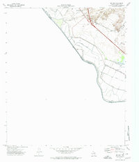
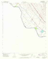
1972 Map of McNary
USGS Topo · Published 1974About this map
The Rio Grande defines the southwestern edge of this Hudspeth County landscape, serving as the international boundary between the United States and Mexico. The alluvial plain is heavily engineered for desert agriculture, dominated by an intricate network of irrigation and drainage infrastructure including the Hudspeth Main Canal, Algodon Canal, and the Mc Nary Lateral. These man-made waterways contrast sharply with the natural drainage of Arroyo Diablo and Madden Arroyo which cut through the higher ground to the northeast.
Find a feature on this map
27 named features on this map. Tap any name to fly to it.
Don’t see what you’re looking for? This feature index may not catch every label — zoom into the map to look around manually.
Map Details
Editions of this 1972 McNary Map
This is the sole edition of this map. No revisions or reprints were ever made.
Other maps of this area

1894 · Fort Hancock
USGS Topo · 1:125,000

1943 · Fort Quitman
USGS Topo · 1:62,500

1943 · Finlay Mountains
USGS Topo · 1:62,500

1943 · Fort Hancock
USGS Topo · 1:62,500
1943 · McNary
USGS Topo · 1:62,500

1954 · Van Horn
USGS Topo · 1:250,000

1958 · Van Horn
USGS Topo · 1:250,000
1972 · Campo Grande Mountain
USGS Topo · 1:24,000
1972 · Fort Hancock
USGS Topo · 1:24,000
1972 · Acala
USGS Topo · 1:24,000