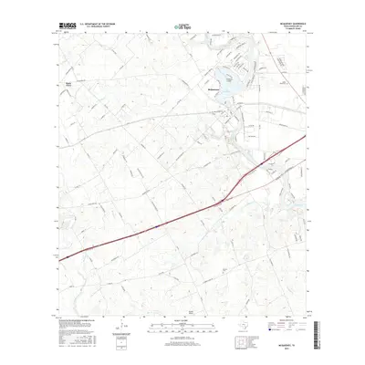
2016 Map of McQueeney
USGS Topo · Published 2016About this map
Lake McQueeney and the winding Guadalupe River define the local geography of this central Texas landscape, where residential developments like Treasure Island sit alongside established rural settlements. The map shows a transition from the structured residential blocks near McQueeney to the more open agricultural and ranching lands around Santa Clara. Significant water features, including Youngs Cr, Buzzard Cr, and the southern reach of Lake Placid, cut through the terrain, highlighting the region's reliance on these drainage basins.
Find a feature on this map
122 named features on this map. Tap any name to fly to it.
Don’t see what you’re looking for? This feature index may not catch every label — zoom into the map to look around manually.
Map Details
Editions of this 2016 McQueeney Map
This is the sole edition of this map. No revisions or reprints were ever made.
Other maps of this area

1911 · San Marcos
USGS Topo · 1:125,000

1919 · San Marcos
USGS Topo · 1:125,000

1920 · Smiley
USGS Topo · 1:125,000

1924 · New Braunfels No 4
USGS Topo · 1:48,000

1924 · San Marcos 3-c
USGS Topo · 1:48,000

1925 · New Braunfels No 1
USGS Topo · 1:48,000

1927 · New Braunfels
USGS Topo · 1:62,500

1930 · Seguin
USGS Topo · 1:62,500

1942 · Dewville
USGS Topo · 1:62,500

1953 · Seguin
USGS Topo · 1:250,000