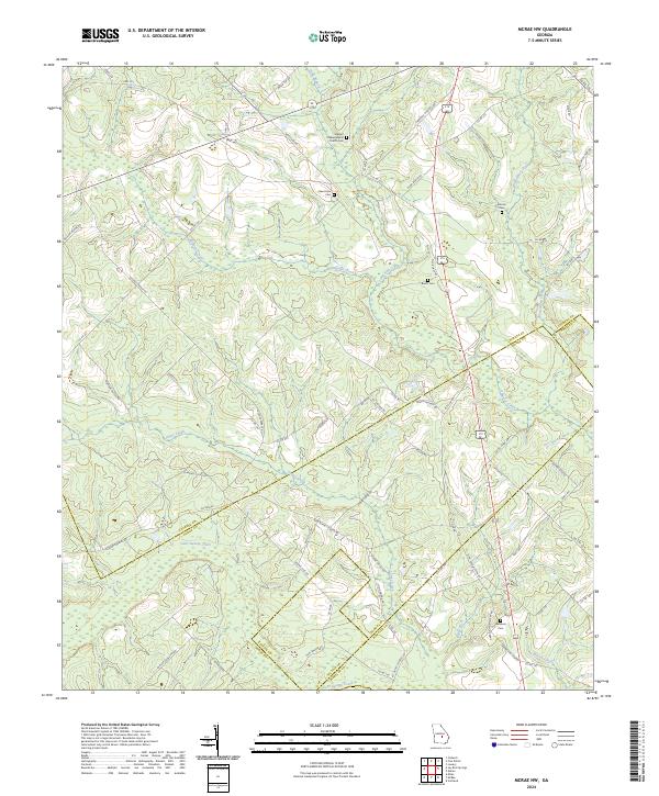
2024 Map of McRae NW
USGS Topo · Published 2024About this map
Stewart Chapel Baptist Church stands as a focal point in the rural landscape where Laurens, Dodge, and Wheeler counties converge. This modern survey illustrates a region defined by its complex drainage network, where the headwaters of Gum Swamp Creek and Alligator Creek carve through the coastal plain. The distribution of family-named landmarks and cemeteries suggests a long-standing agrarian community, with sites like Harrelson Cem and Burch Cem situated near historical road corridors such as Hugh Burch Rd and Ella Burch Rd.
Find a feature on this map
75 named features on this map. Tap any name to fly to it.
Don’t see what you’re looking for? This feature index may not catch every label — zoom into the map to look around manually.
Map Details
Editions of this 2024 McRae NW Map
This is the sole edition of this map. No revisions or reprints were ever made.
Other maps of this area

1957 · Macon
USGS Topo · 1:250,000

1958 · Macon
USGS Topo · 1:250,000

1964 · Macon
USGS Topo · 1:250,000

1970 · Scotland
USGS Topo · 1:24,000

1970 · Alamo
USGS Topo · 1:24,000

1972 · Mc Rae NW
USGS Topo · 1:24,000

1972 · Jay Bird Springs
USGS Topo · 1:24,000
1972 · Milan
USGS Topo · 1:24,000
1972 · Mc Rae
USGS Topo · 1:24,000

1973 · Cadwell
USGS Topo · 1:24,000