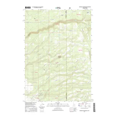
2017 Map of McRenolds Reservoir
USGS Topo · Published 2017About this map
McRenolds Reservoir sits at the heart of this high-altitude landscape along the Idaho-Wyoming border, where the headwaters of numerous creeks drain the western slopes of the Teton range. The area is defined by a dense network of forest roads and trails within the Targhee National Forest, including the Jackpine-Pinochle Loop and Tiehack road, which provide access to significant topographic features like Rammell Mtn and Tepee Ridge.
Find a feature on this map
62 named features on this map. Tap any name to fly to it.
Don’t see what you’re looking for? This feature index may not catch every label — zoom into the map to look around manually.
Map Details
Editions of this 2017 McRenolds Reservoir Map
This is the sole edition of this map. No revisions or reprints were ever made.
Other maps of this area

1886 · Shoshone
USGS Topo · 1:125,000

1888 · Shoshone
USGS Topo · 1:125,000

1895 · Shoshone
USGS Topo · 1:125,000

1899 · Grand Teton
USGS Topo · 1:125,000

1901 · Shoshone
USGS Topo · 1:125,000

1901 · Grand Teton
USGS Topo · 1:125,000

1908 · Shoshone
USGS Topo · 1:125,000

1911 · Shoshone
USGS Topo · 1:125,000

1955 · Ashton
USGS Topo · 1:250,000

1955 · Driggs
USGS Topo · 1:250,000