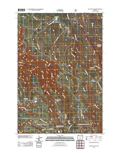
2011 Map of Meacham Lake
USGS Topo · Published 2011About this map
Meacham Lake sits at the northern edge of this high-elevation landscape in the Blue Mountains, where the headwaters of numerous creeks begin their descent through the timbered terrain. The small settlements of Ross and Kamela are established along the drainage of Meacham Creek, reflecting the importance of water and transportation corridors in this corner of Umatilla County. In the southern portion of the quadrangle, the terrain rises toward prominent landforms like Blue Kettle Ridge and Salmon Back Ridge, which separate the various watersheds of McKay Creek and Bear Creek.
Find a feature on this map
31 named features on this map. Tap any name to fly to it.
Don’t see what you’re looking for? This feature index may not catch every label — zoom into the map to look around manually.
Map Details
Editions of this 2011 Meacham Lake Map
This is the sole edition of this map. No revisions or reprints were ever made.
Other maps of this area

1935 · Pendleton
USGS Topo · 1:125,000

1953 · Pendleton
USGS Topo · 1:250,000

1956 · Pendleton
USGS Topo · 1:250,000

1963 · Meacham Lake
USGS Topo · 1:24,000

1964 · Mc Intyre Creek
USGS Topo · 1:24,000

1964 · Duncan
USGS Topo · 1:24,000

1964 · Huron
USGS Topo · 1:24,000

1964 · Meacham
USGS Topo · 1:24,000

1964 · Kamela SE
USGS Topo · 1:24,000

1966 · Cabbage Hill
USGS Topo · 1:24,000