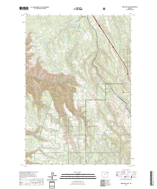
2023 Map of Meacham Lake
USGS Topo · Published 2023About this map
Meacham sits as the primary settlement on this portion of the Blue Mountains, where the landscape is defined by the high ridges and deep canyons of the Umatilla National Forest. The geography is shaped by the drainage systems of Meacham Creek and McKay Creek, with prominent landforms like Blue Kettle Ridge and Salmon Back Ridge dividing the territory. Small water sources and localized improvements such as Folsoms Spring, Snipe Spring, and Forks Tank appear alongside forest development roads, indicating the management of these timberlands. Transport history is visible in the alignment of Old US Hwy 30, which follows the natural corridors through Railroad Canyon and along Tod Creek. This modern survey also documents the eastern reaches of the Whitman National Forest and the transition into Union Co at the quadrangle's eastern edge.
Find a feature on this map
45 named features on this map. Tap any name to fly to it.
Don’t see what you’re looking for? This feature index may not catch every label — zoom into the map to look around manually.
Map Details
Editions of this 2023 Meacham Lake Map
This is the sole edition of this map. No revisions or reprints were ever made.
Other maps of this area

1935 · Pendleton
USGS Topo · 1:125,000

1953 · Pendleton
USGS Topo · 1:250,000

1956 · Pendleton
USGS Topo · 1:250,000

1963 · Meacham Lake
USGS Topo · 1:24,000

1964 · Mc Intyre Creek
USGS Topo · 1:24,000

1964 · Duncan
USGS Topo · 1:24,000

1964 · Huron
USGS Topo · 1:24,000

1964 · Meacham
USGS Topo · 1:24,000

1964 · Kamela SE
USGS Topo · 1:24,000

1966 · Cabbage Hill
USGS Topo · 1:24,000