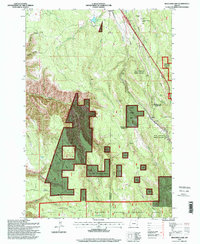
1995 Map of Meacham Lake
USGS Topo · Published 1998About this map
Meacham and Kamela anchor this high-elevation landscape in the Blue Mountains, where the historic Old Indian Treaty Boundary carves a diagonal line through the forest. The mapping shows a working landscape of resource management and early weather observation, evidenced by the U.S. Weather Bureau Station and an Airway Beacon positioned near the crest. Much of the territory is defined by the Umatilla National Forest and the Wallowa Whitman National Forest, with the Blue Mountain Forest Wayside preserving a corridor for travelers along the modern transportation route. For local history, several isolated Grave sites and family-named landmarks like Folsoms Spring and Johnson Ridge provide specific points of interest. Water features such as Meacham Lake and Meacham Creek drain the steep canyons of Coyote Canyon and Dark Canyon.
Find a feature on this map
35 named features on this map. Tap any name to fly to it.
Don’t see what you’re looking for? This feature index may not catch every label — zoom into the map to look around manually.
Map Details
Editions of this 1995 Meacham Lake Map
This is the sole edition of this map. No revisions or reprints were ever made.
Other maps of this area

1935 · Pendleton
USGS Topo · 1:125,000

1953 · Pendleton
USGS Topo · 1:250,000

1956 · Pendleton
USGS Topo · 1:250,000

1963 · Meacham Lake
USGS Topo · 1:24,000

1964 · Mc Intyre Creek
USGS Topo · 1:24,000

1964 · Duncan
USGS Topo · 1:24,000

1964 · Huron
USGS Topo · 1:24,000

1964 · Meacham
USGS Topo · 1:24,000

1964 · Kamela SE
USGS Topo · 1:24,000

1966 · Cabbage Hill
USGS Topo · 1:24,000