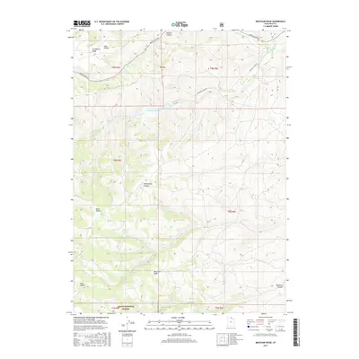
2017 Map of Meachum Ridge
USGS Topo · Published 2017About this map
Woodruff Reservoir sits at the heart of this high-elevation landscape in Rich County, Utah, where seasonal water management and grazing allotments define the local economy. The terrain is characterized by a series of prominent north-south elevations, including Strawberry Ridge and Meachum Ridge, which provide natural boundaries for the Cache National Forest. In the northern sections, drainage patterns through Walton Canyon and along Birch Cr showcase the intricate network of canyons and hollows that feed into the larger Bear River system. Infrastructure remains sparse, centered on vital transit corridors like Monte Cristo Rd and Woodruff Creek Rd, which provide access to Red Mtn and the isolated livestock grazing areas of Wheatgrass Hollow.
Find a feature on this map
21 named features on this map. Tap any name to fly to it.
Don’t see what you’re looking for? This feature index may not catch every label — zoom into the map to look around manually.
Map Details
Editions of this 2017 Meachum Ridge Map
This is the sole edition of this map. No revisions or reprints were ever made.
Other maps of this area

1912 · Randolph
USGS Topo · 1:125,000

1954 · Ogden
USGS Topo · 1:250,000

1958 · Ogden
USGS Topo · 1:250,000

1960 · Ogden
USGS Topo · 1:250,000

1968 · Horse Ridge
USGS Topo · 1:24,000

1968 · Dairy Ridge
USGS Topo · 1:24,000

1968 · Woodruff
USGS Topo · 1:24,000

1968 · Mc Kay Hollow
USGS Topo · 1:24,000

1968 · Meachum Ridge
USGS Topo · 1:24,000

1968 · Peck Canyon
USGS Topo · 1:24,000