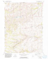
1991 Map of Meachum Ridge
USGS Topo · Published 1991About this map
Woodruff Reservoir sits at the heart of this high-elevation terrain in Rich County, managed by the Woodruff Creek Dam as part of the regional water system. The landscape is defined by the prominent Meachum Ridge and the steep descents into Meachum Canyon and Home Canyon. A network of 4WD trails and a significant pipeline traverse the ridges, indicating the modern utility of these highlands for energy and water transport. Much of the southern portion of the map is contained within the Cache National Forest, where the terrain rises toward Strawberry Ridge. The presence of a Gravel Pit and Borrow Pit in the northwest suggests localized resource extraction near Walton Canyon. This map preserves the 1990s character of a remote Utah backcountry, where land use was balanced between federal forest management and critical water storage infrastructure.
Find a feature on this map
20 named features on this map. Tap any name to fly to it.
Don’t see what you’re looking for? This feature index may not catch every label — zoom into the map to look around manually.
Map Details
Editions of this 1991 Meachum Ridge Map
This is the sole edition of this map. No revisions or reprints were ever made.
Other maps of this area

1912 · Randolph
USGS Topo · 1:125,000

1954 · Ogden
USGS Topo · 1:250,000

1958 · Ogden
USGS Topo · 1:250,000

1960 · Ogden
USGS Topo · 1:250,000

1968 · Horse Ridge
USGS Topo · 1:24,000

1968 · Dairy Ridge
USGS Topo · 1:24,000

1968 · Woodruff
USGS Topo · 1:24,000

1968 · Mc Kay Hollow
USGS Topo · 1:24,000

1968 · Meachum Ridge
USGS Topo · 1:24,000

1968 · Peck Canyon
USGS Topo · 1:24,000