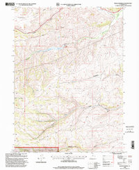
1998 Map of Meachum Ridge
USGS Topo · Published 2001About this map
Cache National Forest encompasses the southern portion of this high-elevation terrain, where water management and extraction define the local economy. The central landscape is dominated by the Woodruff Reservoir, held by the Woodruff Creek Dam, serving as a critical water source for the surrounding drainage basins. This 1998 revision of a 1960s survey illustrates a landscape of utility, featuring an extensive Pipeline network and multiple resource extraction sites such as a Gravel Pit and an additional Pit near the Ogden River.
Find a feature on this map
19 named features on this map. Tap any name to fly to it.
Don’t see what you’re looking for? This feature index may not catch every label — zoom into the map to look around manually.
Map Details
Editions of this 1998 Meachum Ridge Map
This is the sole edition of this map. No revisions or reprints were ever made.
Other maps of this area

1912 · Randolph
USGS Topo · 1:125,000

1954 · Ogden
USGS Topo · 1:250,000

1958 · Ogden
USGS Topo · 1:250,000

1960 · Ogden
USGS Topo · 1:250,000

1968 · Horse Ridge
USGS Topo · 1:24,000

1968 · Dairy Ridge
USGS Topo · 1:24,000

1968 · Woodruff
USGS Topo · 1:24,000

1968 · Mc Kay Hollow
USGS Topo · 1:24,000

1968 · Meachum Ridge
USGS Topo · 1:24,000

1968 · Peck Canyon
USGS Topo · 1:24,000