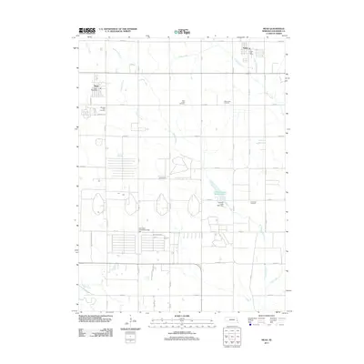
2011 Map of Mead
USGS Topo · Published 2011About this map
The village of Mead and its agricultural surroundings in Saunders County are the focus of this 2011 survey. The landscape is defined by a dense grid of county roads that organize the Nebraska prairie into productive parcels, anchored by the University of Nebraska Field Lab which occupies a significant portion of the central terrain. This institutional presence contrasts with the traditional settlement patterns seen at the eastern edge of the map in Yutan.
Find a feature on this map
44 named features on this map. Tap any name to fly to it.
Don’t see what you’re looking for? This feature index may not catch every label — zoom into the map to look around manually.
Map Details
Editions of this 2011 Mead Map
This is the sole edition of this map. No revisions or reprints were ever made.
Other maps of this area

1893 · Fremont
USGS Topo · 1:125,000

1896 · Fremont
USGS Topo · 1:125,000

1899 · Wahoo
USGS Topo · 1:125,000

1955 · Fremont
USGS Topo · 1:250,000

1957 · Fremont
USGS Topo · 1:250,000

1958 · Fremont
USGS Topo · 1:250,000

1968 · Valley
USGS Topo · 1:24,000
1968 · Ashland East
USGS Topo · 1:24,000

1968 · Leshara
USGS Topo · 1:24,000
1968 · Wann
USGS Topo · 1:24,000