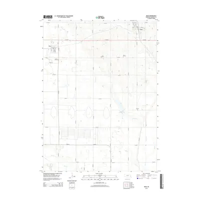
2014 Map of Mead
USGS Topo · Published 2014About this map
Yutan and Mead anchor this portion of Saunders County, where the agricultural grid of eastern Nebraska is defined by a dense network of county roads. The landscape is carved by the winding paths of Clear Cr and Johnson Cr, which drain toward the south and east. A significant water management feature, Johnson Cr Reservoir 22-A, appears in the central portion of the map, illustrating local efforts to control the prairie waterways.
Find a feature on this map
42 named features on this map. Tap any name to fly to it.
Don’t see what you’re looking for? This feature index may not catch every label — zoom into the map to look around manually.
Map Details
Editions of this 2014 Mead Map
This is the sole edition of this map. No revisions or reprints were ever made.
Other maps of this area

1893 · Fremont
USGS Topo · 1:125,000

1896 · Fremont
USGS Topo · 1:125,000

1899 · Wahoo
USGS Topo · 1:125,000

1955 · Fremont
USGS Topo · 1:250,000

1957 · Fremont
USGS Topo · 1:250,000

1958 · Fremont
USGS Topo · 1:250,000

1968 · Valley
USGS Topo · 1:24,000
1968 · Ashland East
USGS Topo · 1:24,000

1968 · Leshara
USGS Topo · 1:24,000
1968 · Wann
USGS Topo · 1:24,000