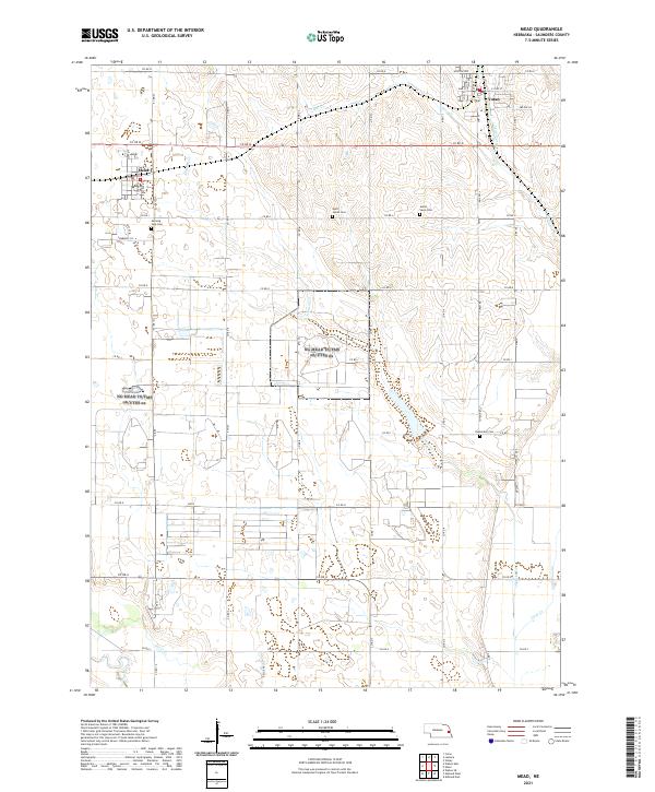
2021 Map of Mead
USGS Topo · Published 2021About this map
Mead and Yutan anchor the landscape of eastern Saunders County in this modern 2021 topographic record. The terrain is defined by the winding paths of Clear Cr and Johnson Cr, which cut through the agricultural sections. Local heritage is preserved in several burial grounds, including Morning Side Cem near the town of Mead and Saint James Cem to the east. Farther south, Parmenter Cem stands near the confluence of local drainages. The grid of county roads, including Co RD M and Yutan Rd, connects these rural centers, while the natural drainage patterns of Silver Cr and Wahoo Creek show the watershed's role in shaping property and township boundaries.
Find a feature on this map
51 named features on this map. Tap any name to fly to it.
Don’t see what you’re looking for? This feature index may not catch every label — zoom into the map to look around manually.
Map Details
Editions of this 2021 Mead Map
This is the sole edition of this map. No revisions or reprints were ever made.
Other maps of this area

1893 · Fremont
USGS Topo · 1:125,000

1896 · Fremont
USGS Topo · 1:125,000

1899 · Wahoo
USGS Topo · 1:125,000

1955 · Fremont
USGS Topo · 1:250,000

1957 · Fremont
USGS Topo · 1:250,000

1958 · Fremont
USGS Topo · 1:250,000

1968 · Valley
USGS Topo · 1:24,000
1968 · Ashland East
USGS Topo · 1:24,000

1968 · Leshara
USGS Topo · 1:24,000
1968 · Wann
USGS Topo · 1:24,000