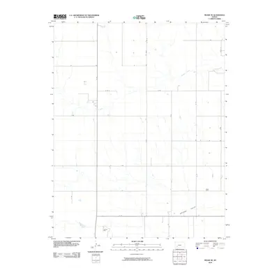
2010 Map of Meade NE
USGS Topo · Published 2010About this map
The Artesian Valley defines the southern portion of this landscape in Gray County, Kansas, where the winding course of Crooked Creek cuts through the prairie. This 2010 survey illustrates a quintessential High Plains agricultural layout, dominated by a strict grid of section-line roads like G Rd, E Rd, and F Rd. A notable industrial presence is marked by the Cudahay Mine, located in the southwest near where the creek bends. The map provides a precise look at the drainage patterns and rural infrastructure of the region during the early 21st century, showing how the land has been subdivided and utilized for both extraction and farming.
Find a feature on this map
19 named features on this map. Tap any name to fly to it.
Don’t see what you’re looking for? This feature index may not catch every label — zoom into the map to look around manually.
Map Details
Editions of this 2010 Meade NE Map
This is the sole edition of this map. No revisions or reprints were ever made.
Other maps of this area

1892 · Meade
USGS Topo · 1:125,000

1892 · Dodge
USGS Topo · 1:125,000

1955 · Dodge City
USGS Topo · 1:250,000

1958 · Dodge City
USGS Topo · 1:250,000

1959 · Dodge City
USGS Topo · 1:250,000

1963 · Meade
USGS Topo · 1:24,000

1963 · Missler
USGS Topo · 1:24,000

1967 · Fowler SW
USGS Topo · 1:24,000

1968 · Montezuma
USGS Topo · 1:24,000
1968 · Meade NW
USGS Topo · 1:24,000