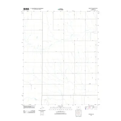
2012 Map of Meade NE
USGS Topo · Published 2012About this map
Crooked Cr snakes through this rural expanse of Gray County, providing the primary topographic relief in an area defined by systematic agricultural partitioning. The landscape is organized by a precise grid of rural routes, including J J Rd, A Rd, and Kk Rd, which reflect the long-standing Section Land Survey system. This 2012 survey illustrates the persistence of large-scale farming and grazing patterns, where water access from the creek remains a vital geographical factor. The map shows how transportation networks, such as B Rd and C Rd, have been established to serve remote farmsteads and facilitate the movement of goods across the High Plains. While few named settlements appear, the presence of various structures along routes like D Rd and E Rd points to the continued occupation and management of the Kansas prairie.
Find a feature on this map
15 named features on this map. Tap any name to fly to it.
Don’t see what you’re looking for? This feature index may not catch every label — zoom into the map to look around manually.
Map Details
Editions of this 2012 Meade NE Map
This is the sole edition of this map. No revisions or reprints were ever made.
Other maps of this area

1892 · Meade
USGS Topo · 1:125,000

1892 · Dodge
USGS Topo · 1:125,000

1955 · Dodge City
USGS Topo · 1:250,000

1958 · Dodge City
USGS Topo · 1:250,000

1959 · Dodge City
USGS Topo · 1:250,000

1963 · Meade
USGS Topo · 1:24,000

1963 · Missler
USGS Topo · 1:24,000

1967 · Fowler SW
USGS Topo · 1:24,000

1968 · Montezuma
USGS Topo · 1:24,000
1968 · Meade NW
USGS Topo · 1:24,000