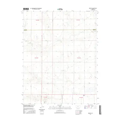
2016 Map of Meade NE
USGS Topo · Published 2016About this map
Crooked Cr defines the drainage of this High Plains landscape as it flows through the northern reaches of the Gray Co Meade Co border. The map illustrates a strictly ordered section-line grid of rural routes, including 18 Rd, Co Rd 19, and Co Rd 23, which crisscross the expansive agricultural terrain. In the southern portion of the sheet, the land descends into the Artesian Valley, a region where the topography shifts and becomes populated with numerous small depressions and seasonal wetlands. This 2016 survey documents the enduring structure of the Public Land Survey System, showing the townships and ranges from t29s r28w down to t31s r27w as they were organized into the early 21st century.
Find a feature on this map
27 named features on this map. Tap any name to fly to it.
Don’t see what you’re looking for? This feature index may not catch every label — zoom into the map to look around manually.
Map Details
Editions of this 2016 Meade NE Map
This is the sole edition of this map. No revisions or reprints were ever made.
Other maps of this area

1892 · Meade
USGS Topo · 1:125,000

1892 · Dodge
USGS Topo · 1:125,000

1955 · Dodge City
USGS Topo · 1:250,000

1958 · Dodge City
USGS Topo · 1:250,000

1959 · Dodge City
USGS Topo · 1:250,000

1963 · Meade
USGS Topo · 1:24,000

1963 · Missler
USGS Topo · 1:24,000

1967 · Fowler SW
USGS Topo · 1:24,000

1968 · Montezuma
USGS Topo · 1:24,000
1968 · Meade NW
USGS Topo · 1:24,000