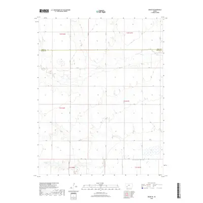
2018 Map of Meade NE
USGS Topo · Published 2018About this map
The Artesian Valley floor dominates the southern reaches of this landscape where Meade and Gray counties meet. The drainage of Crooked Cr meanders across the northern and eastern sections, defining a terrain of subtle elevation changes and local watersheds. This 2018 survey illustrates a highly organized section-line grid system, where long agricultural roads like G Rd, Jj Rd, and 18 Rd serve as the primary infrastructure for this rural High Plains environment. The map provides a clear look at the large-scale land management patterns in this part of Kansas, showing the precise boundaries between townships such as t30s r27w and t29s r28w. The presence of small ponds and wetland pockets scattered across the central sections suggests the intermittent nature of water in this semi-arid region.
Find a feature on this map
28 named features on this map. Tap any name to fly to it.
Don’t see what you’re looking for? This feature index may not catch every label — zoom into the map to look around manually.
Map Details
Editions of this 2018 Meade NE Map
This is the sole edition of this map. No revisions or reprints were ever made.
Other maps of this area

1892 · Meade
USGS Topo · 1:125,000

1892 · Dodge
USGS Topo · 1:125,000

1955 · Dodge City
USGS Topo · 1:250,000

1958 · Dodge City
USGS Topo · 1:250,000

1959 · Dodge City
USGS Topo · 1:250,000

1963 · Meade
USGS Topo · 1:24,000

1963 · Missler
USGS Topo · 1:24,000

1967 · Fowler SW
USGS Topo · 1:24,000

1968 · Montezuma
USGS Topo · 1:24,000
1968 · Meade NW
USGS Topo · 1:24,000