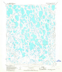
1955 Map of Meade River A-1
USGS Topo · Published 1967About this map
The Topagoruk River and Usuktuk River wind through an intricate landscape of Arctic thermokarst lakes in this mid-1950s survey of Naval Petroleum Reserve No. 4. This area is characterized by a high density of water bodies, including the prominent Paddle Lake and Citellus Lake, which are interspersed with low-lying terrain markers such as Ray, Rod, and Kim. The presence of a Tractor Trail cutting through the western and southern sectors indicates the early methods of overland transport used for exploration and logistics in this remote northern environment. Located within the North Slope, the map illustrates a transition point between meandering river systems and the vast network of thaw lakes that dominate the coastal plain. A single landmark elevation at Butte in the southeast provides one of the few named topographic relief points in this otherwise saturated drainage basin.
Find a feature on this map
14 named features on this map. Tap any name to fly to it.
Don’t see what you’re looking for? This feature index may not catch every label — zoom into the map to look around manually.
Map Details
Editions of this 1955 Meade River A-1 Map
This is the sole edition of this map. No revisions or reprints were ever made.
Other maps of this area

1951 · Meade River
USGS Topo · 1:250,000

1951 · Lookout Ridge
USGS Topo · 1:250,000

1951 · Teshekpuk
USGS Topo · 1:250,000

1951 · Ikpikpuk River
USGS Topo · 1:250,000

1955 · Teshekpuk
USGS Topo · 1:250,000
1955 · Teshekpuk A-5
USGS Topo · 1:63,360
1955 · Teshekpuk B-5
USGS Topo · 1:63,360

1955 · Meade River
USGS Topo · 1:250,000

1955 · Meade River B-1
USGS Topo · 1:63,360

1955 · Meade River A-2
USGS Topo · 1:63,360