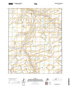
2020 Map of Meade River A-4 SE
USGS Topo · Published 2020About this map
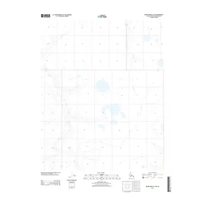
Nigisaktuvik River meanders across this Arctic landscape in the North Slope Borough, carving a complex network of oxbows and seasonal channels through the tundra. The terrain is defined by low-lying permafrost drainage, where the river flows northward toward the Arctic coast. In the eastern portion of the sheet, Kowlak Cr drains the low uplands, joining the larger hydrologic systems of the Meade River basin. The absence of roads or permanent structures reflects the isolation of the National Petroleum Reserve in Alaska during the early twenty-first century. The grid of township and range lines, including t9n r24w and t8n r25w, provides a surveyor's framework over an otherwise trackless wilderness of braided streams and thaw lakes.
Find a feature on this map
7 named features on this map. Tap any name to fly to it.
Don’t see what you’re looking for? This feature index may not catch every label — zoom into the map to look around manually.
Map Details
Editions of this 2020 Meade River A-4 SE Map
This is the sole edition of this map. No revisions or reprints were ever made.
Other maps of this area

1951 · Meade River
USGS Topo · 1:250,000

1951 · Lookout Ridge
USGS Topo · 1:250,000

1955 · Meade River
USGS Topo · 1:250,000

1955 · Meade River A-3
USGS Topo · 1:63,360
1955 · Meade River A-4
USGS Topo · 1:63,360

1956 · Lookout Ridge
USGS Topo · 1:250,000
1984 · Lookout Ridge D-4
USGS Topo · 1:63,360

1984 · Lookout Ridge D-3
USGS Topo · 1:63,360
2013 · Lookout Ridge D-3 NW
USGS Topo · 1:25,000
2013 · Meade River A-3 SW
USGS Topo · 1:25,000