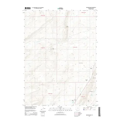
2015 Map of Meadow Draw
USGS Topo · Published 2015About this map
Cumberland Flats dominates the central landscape of this Uinta County region, where the high-elevation drainage patterns of the western Wyoming interior are clearly defined. The terrain is characterized by a series of prominent ridges and depressions, most notably the dual features of Little Hogsback and The Hogsback. These north-south oriented formations dictate the flow of local waterways, including Clear Cr and Shurtleff Cr, which navigate the base of landmarks like Round Mtn.
Find a feature on this map
21 named features on this map. Tap any name to fly to it.
Don’t see what you’re looking for? This feature index may not catch every label — zoom into the map to look around manually.
Map Details
Editions of this 2015 Meadow Draw Map
This is the sole edition of this map. No revisions or reprints were ever made.
Other maps of this area

1954 · Ogden
USGS Topo · 1:250,000

1958 · Ogden
USGS Topo · 1:250,000

1960 · Ogden
USGS Topo · 1:250,000

1962 · Cumberland Gap
USGS Topo · 1:24,000

1962 · Elkol SW
USGS Topo · 1:24,000

1962 · Bell Butte
USGS Topo · 1:24,000

1965 · Bridger
USGS Topo · 1:24,000

1965 · Ragan
USGS Topo · 1:24,000

1965 · Leroy
USGS Topo · 1:24,000

1965 · Little Dee Creek
USGS Topo · 1:24,000