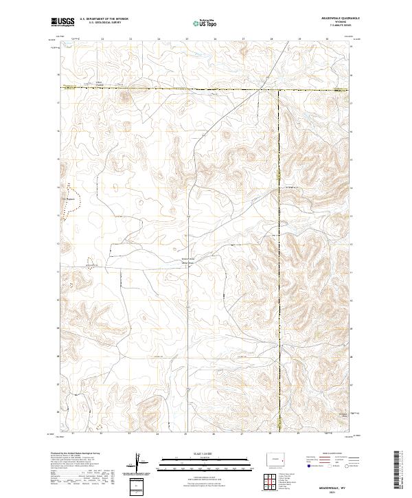
2021 Map of Meadowdale
USGS Topo · Published 2021About this map
The Wildcat Hills rise in the southeastern corner of this landscape, where the borders of Platte, Goshen, and Niobara counties meet. This ranchland terrain is defined by its drainage patterns and prominent geological landmarks. Narrow drainage paths like Vincent Draw and Miller Draw cut through the high plains, while Willow Cr winds across the northern sections. The survey highlights a network of local ranch roads, including Meadowdale Rd and Jireh Rd, which provide access to the isolated homesteads and grazing lands that characterize this part of Wyoming.
Find a feature on this map
20 named features on this map. Tap any name to fly to it.
Don’t see what you’re looking for? This feature index may not catch every label — zoom into the map to look around manually.
Map Details
Editions of this 2021 Meadowdale Map
This is the sole edition of this map. No revisions or reprints were ever made.
Other maps of this area

1896 · Hartville
USGS Topo · 1:125,000

1901 · Hartville
USGS Topo · 1:125,000

1949 · Cedar Top
USGS Topo · 1:24,000

1950 · Cedar Top
USGS Topo · 1:24,000

1950 · Prairie View School
USGS Topo · 1:24,000

1950 · Haushar Ranch
USGS Topo · 1:24,000

1950 · Hell Gap
USGS Topo · 1:24,000

1951 · Haushar Ranch
USGS Topo · 1:24,000
1951 · Hell Gap
USGS Topo · 1:24,000

1951 · Moore Spring
USGS Topo · 1:24,000