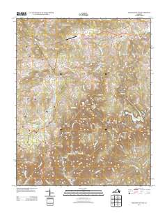
2013 Map of Meadows of Dan
USGS Topo · Published 2013About this map
Meadows of Dan serves as a focal point in this portion of the Blue Ridge, where high-elevation plateaus drop precipitously into the river gorges below. The landscape is defined by the dramatic descent of the Dan River, featuring the Great Falls of Dan and the iconic Pinnacles of Dan. Hydropower and water management are central to the area's development, evidenced by Talbott Reservoir and Townes Reservoir. Cultural landmarks like the Cockram Mill and the Mayberry Church Rd corridor reflect the deep-rooted community history of Patrick County. Transportation follows the natural contours of the land, with the Blue Ridge Pkwy winding through the western hills, connecting smaller settlements like Pike City and Bell Spur. The map also captures the distinct geography of Kibler Valley and the various knobs, such as Hurricane Knob and Turkey Nest Knob, that punctuate this mountain terrain.
Find a feature on this map
136 named features on this map. Tap any name to fly to it.
Don’t see what you’re looking for? This feature index may not catch every label — zoom into the map to look around manually.
Map Details
Editions of this 2013 Meadows of Dan Map
This is the sole edition of this map. No revisions or reprints were ever made.
Other maps of this area

1889 · Hillsville
USGS Topo · 1:125,000

1892 · Hillsville
USGS Topo · 1:125,000

1896 · Hillsville
USGS Topo · 1:125,000

1928 · Stuart
USGS Topo · 1:48,000

1931 · Stuart
USGS Topo · 1:62,500

1953 · Winston-Salem
USGS Topo · 1:250,000

1955 · Winston-Salem
USGS Topo · 1:250,000

1956 · Macks Mountain
USGS Topo · 1:62,500

1957 · Mount Airy
USGS Topo · 1:62,500

1957 · Floyd
USGS Topo · 1:62,500