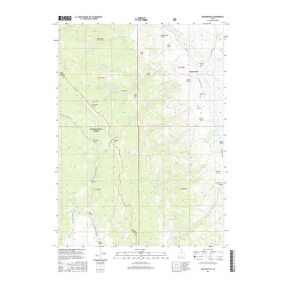
2017 Map of Meadowville
USGS Topo · Published 2017About this map
The settlement of Meadowville lies at the edge of the Meadowville Valley in this northern Utah landscape, where the eastern slopes of the Cache National Forest meet the high desert flats. The terrain is defined by a series of steep canyons and ridges, including Jebo Canyon, Slideout Canyon, and Log Cabin Ridge, which feed into the wider basin of Round Valley. For local historians and genealogists, the Meadowville Cem serves as a vital anchor point for the small community.
Find a feature on this map
58 named features on this map. Tap any name to fly to it.
Don’t see what you’re looking for? This feature index may not catch every label — zoom into the map to look around manually.
Map Details
Editions of this 2017 Meadowville Map
This is the sole edition of this map. No revisions or reprints were ever made.
Other maps of this area

1912 · Randolph
USGS Topo · 1:125,000

1914 · Logan
USGS Topo · 1:125,000

1916 · Logan
USGS Topo · 1:125,000

1949 · Boulter Mts
USGS Topo · 1:24,000

1954 · Ogden
USGS Topo · 1:250,000

1958 · Ogden
USGS Topo · 1:250,000

1960 · Ogden
USGS Topo · 1:250,000
1969 · Tony Grove Creek
USGS Topo · 1:24,000

1969 · Boulder Mtn
USGS Topo · 1:24,000
1969 · Red Spur Mtn
USGS Topo · 1:24,000