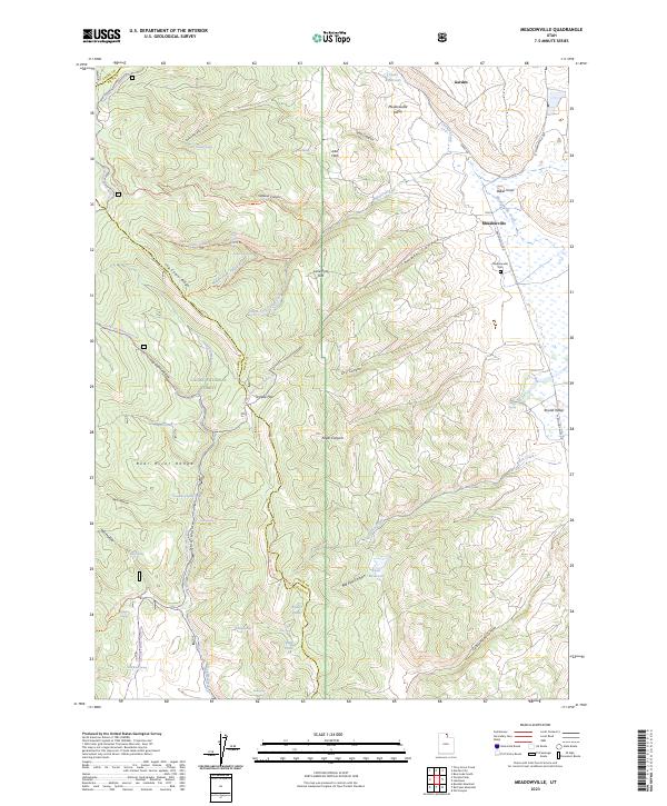
2023 Map of Meadowville
USGS Topo · Published 2023About this map
The settlement of Meadowville lies at the edge of the Meadowville Valley, where the high elevations of the Bear River Range descend into the flats east of the Cache National Forest. This modern record of the Rich County landscape captures the established rural infrastructure of Meadowville Creek and Birch Creek, which feed into the valley bottom. Higher elevations are marked by a complex network of canyons and hollows, including Jebo Canyon, Temple Canyon, and Hells Hollow. Local history is anchored by the Meadowville Cem, situated near the town site. The map reflects a landscape deeply shaped by seasonal activities and water management, evidenced by numerous developed springs like Jebo Spring and Nebeker Spring, alongside the Sinks Trail Winter Sport Trl and various ATV trails that traverse the forest boundaries.
Find a feature on this map
60 named features on this map. Tap any name to fly to it.
Don’t see what you’re looking for? This feature index may not catch every label — zoom into the map to look around manually.
Map Details
Editions of this 2023 Meadowville Map
This is the sole edition of this map. No revisions or reprints were ever made.
Other maps of this area

1912 · Randolph
USGS Topo · 1:125,000

1914 · Logan
USGS Topo · 1:125,000

1916 · Logan
USGS Topo · 1:125,000

1949 · Boulter Mts
USGS Topo · 1:24,000

1954 · Ogden
USGS Topo · 1:250,000

1958 · Ogden
USGS Topo · 1:250,000

1960 · Ogden
USGS Topo · 1:250,000
1969 · Tony Grove Creek
USGS Topo · 1:24,000

1969 · Boulder Mtn
USGS Topo · 1:24,000
1969 · Red Spur Mtn
USGS Topo · 1:24,000