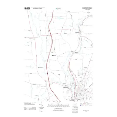
2013 Map of Meadville
USGS Topo · Published 2013About this map
French Creek carves a central path through Crawford County, defining the corridor between Saegertown and the northern reaches of Meadville. This 2013 survey illustrates a landscape of established crossroads communities and small settlements like Littles Corners, Coons Corners, and Blacks Corner, which reflect the historic rural infrastructure of western Pennsylvania. To the south, the terrain transitions into more industrial and residential layouts near Fredericksburg and Kerrtown, where urban development meets the water at the Smock Memorial Bridge.
Find a feature on this map
38 named features on this map. Tap any name to fly to it.
Don’t see what you’re looking for? This feature index may not catch every label — zoom into the map to look around manually.
Map Details
Editions of this 2013 Meadville Map
This is the sole edition of this map. No revisions or reprints were ever made.
Other maps of this area

1900 · Girard
USGS Topo · 1:62,500

1906 · Linesville
USGS Topo · 1:62,500

1908 · Linesville
USGS Topo · 1:62,500

1923 · Meadville
USGS Topo · 1:62,500

1923 · Cambridge Springs
USGS Topo · 1:62,500

1925 · Meadville
USGS Topo · 1:62,500

1925 · Cambridge Springs
USGS Topo · 1:62,500

1943 · Meadville
USGS Topo · 1:62,500

1943 · Cambridge Springs
USGS Topo · 1:62,500

1950 · Cleveland
USGS Topo · 1:250,000