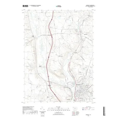
2019 Map of Meadville
USGS Topo · Published 2019About this map
French Creek and Cussewago Creek define the geography of this Crawford County region, meeting south of Meadville. The landscape is a network of historic rural crossroads such as Littles Corners, Coons Corners, Blacks Corner, and Onspaugh Corners, many of which developed around family-named cemeteries and early infrastructure. The city of Meadville serves as the primary hub, housing Allegheny College and the Crawford County Judicial Center. Significant river crossings, including the Smock Memorial Bridge and McGuffintown Bridge, underscore the importance of the waterways to the local transport pattern. To the north, Saegertown sits at the confluence of several tributaries, including Woodcock Creek and Wolf Run. The area's commemorative history is well-preserved through numerous burial grounds like Greendale Cem, Saint Agatha's Cem, and Hickernell Cem, providing a detailed record of the families who settled this part of Pennsylvania.
Find a feature on this map
90 named features on this map. Tap any name to fly to it.
Don’t see what you’re looking for? This feature index may not catch every label — zoom into the map to look around manually.
Map Details
Editions of this 2019 Meadville Map
This is the sole edition of this map. No revisions or reprints were ever made.
Other maps of this area

1900 · Girard
USGS Topo · 1:62,500

1906 · Linesville
USGS Topo · 1:62,500

1908 · Linesville
USGS Topo · 1:62,500

1923 · Meadville
USGS Topo · 1:62,500

1923 · Cambridge Springs
USGS Topo · 1:62,500

1925 · Meadville
USGS Topo · 1:62,500

1925 · Cambridge Springs
USGS Topo · 1:62,500

1943 · Meadville
USGS Topo · 1:62,500

1943 · Cambridge Springs
USGS Topo · 1:62,500

1950 · Cleveland
USGS Topo · 1:250,000