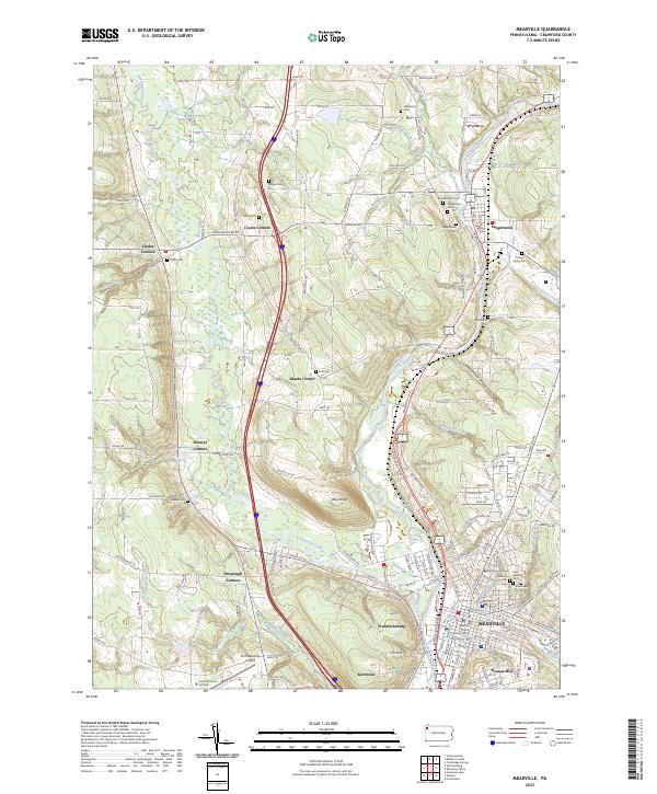
2023 Map of Meadville
USGS Topo · Published 2023About this map
French Creek and Cussewago Creek define the valley floor where the city of Meadville grew into a regional center for education and law. As the site of Allegheny College and the Crawford County Judicial Center, this area has long served as an intellectual and administrative hub for northwestern Pennsylvania. The residential expansion of Kerrtown, Neason Hill, and Fredericksburg shows the city's twentieth-century footprint, while the northern reaches of the map retain their agrarian character through established crossroads like Saegertown and Littles Corners. Numerous family and community burial grounds, such as Saint Agatha's Cem and the County Home Cem, offer significant leads for genealogical research. The landscape is also marked by the presence of the Port Meadville Airport and prominent terrain features like Round Top, providing a comprehensive look at the intersection of river-valley topography and urban development.
Find a feature on this map
135 named features on this map. Tap any name to fly to it.
Don’t see what you’re looking for? This feature index may not catch every label — zoom into the map to look around manually.
Map Details
Editions of this 2023 Meadville Map
This is the sole edition of this map. No revisions or reprints were ever made.
Other maps of this area

1900 · Girard
USGS Topo · 1:62,500

1906 · Linesville
USGS Topo · 1:62,500

1908 · Linesville
USGS Topo · 1:62,500

1923 · Meadville
USGS Topo · 1:62,500

1923 · Cambridge Springs
USGS Topo · 1:62,500

1925 · Meadville
USGS Topo · 1:62,500

1925 · Cambridge Springs
USGS Topo · 1:62,500

1943 · Meadville
USGS Topo · 1:62,500

1943 · Cambridge Springs
USGS Topo · 1:62,500

1950 · Cleveland
USGS Topo · 1:250,000