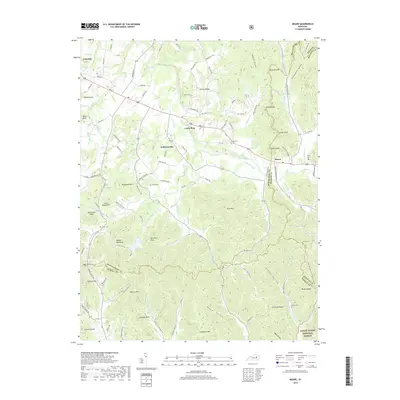
2019 Map of Means
USGS Topo · Published 2019About this map
Jeffersonville and Means serve as the primary hubs in this part of Kentucky, where the landscape transitions into the hills of the Daniel Boone National Forest. The map detail reveals a high concentration of family-named landmarks and hollows, reflecting the deep-rooted settlement patterns of Montgomery, Menifee, and Powell counties. Notable knobs like Big Round Mtn and Wagon Bed Knob rise above the drainage basins of Slate Creek and Upper Spruce Cr. Genealogical researchers will find several well-defined burial sites across the terrain, including Lovely Cem, Martin Cem, and Gillum Cem. The road network, including the path of Main St and various rural routes like Calk Lake Rd, connects the small communities and outlying residences to the local water sources and timbered ridges that have long defined the regional economy and social geography.
Find a feature on this map
116 named features on this map. Tap any name to fly to it.
Don’t see what you’re looking for? This feature index may not catch every label — zoom into the map to look around manually.
Map Details
Editions of this 2019 Means Map
This is the sole edition of this map. No revisions or reprints were ever made.
Other maps of this area

1892 · Beattyville
USGS Topo · 1:125,000

1929 · Salt Lick
USGS Topo · 1:62,500

1934 · Salt Lick
USGS Topo · 1:62,500

1950 · Levee
USGS Topo · 1:24,000

1952 · Preston
USGS Topo · 1:24,000

1952 · Clay City
USGS Topo · 1:24,000

1952 · Mount Sterling
USGS Topo · 1:24,000

1952 · Frenchburg
USGS Topo · 1:24,000

1952 · Stanton
USGS Topo · 1:24,000

1952 · Means
USGS Topo · 1:24,000