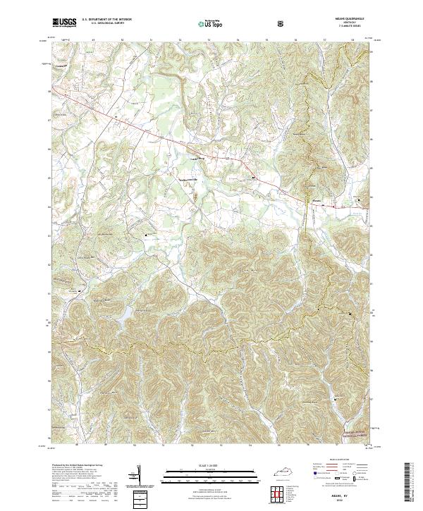
2022 Map of Means
USGS Topo · Published 2022About this map
Slate Creek and its many branches wind through this complex topography where the foothills of the Cumberland Plateau meet the rolling lowlands of the Bluegrass region. The landscape is defined by a dense network of knobs and ridges, including Sand Mtn, Horselick Knob, and Wagon Bed Knob, many of which fall within the protected boundaries of the Daniel Boone National Forest. Small settlements like Jeffersonville and Means serve as local hubs, connected by a web of rural roads that follow the contours of the land.
Find a feature on this map
128 named features on this map. Tap any name to fly to it.
Don’t see what you’re looking for? This feature index may not catch every label — zoom into the map to look around manually.
Map Details
Editions of this 2022 Means Map
This is the sole edition of this map. No revisions or reprints were ever made.
Other maps of this area

1892 · Beattyville
USGS Topo · 1:125,000

1929 · Salt Lick
USGS Topo · 1:62,500

1934 · Salt Lick
USGS Topo · 1:62,500

1950 · Levee
USGS Topo · 1:24,000

1952 · Preston
USGS Topo · 1:24,000

1952 · Clay City
USGS Topo · 1:24,000

1952 · Mount Sterling
USGS Topo · 1:24,000

1952 · Frenchburg
USGS Topo · 1:24,000

1952 · Stanton
USGS Topo · 1:24,000

1952 · Means
USGS Topo · 1:24,000