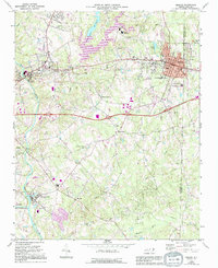
1969 Map of Mebane
USGS Topo · Published 1994About this map
The Haw River and the Southern railroad corridor define the industrial and residential development of this Piedmont landscape, as seen during a period of significant growth between the late 1960s and early 1990s. The settlement of Mebane serves as a primary hub, while smaller communities like Swepsonville and Hawfields illustrate the traditional textile and agricultural footprint of the region. Local religious life is well-documented through numerous landmarks such as Hawfields United Ch, Hebron Ch, and Phillips Chapel. Modern infrastructure is visible through the expansion of Interstate 85 and the development of Quaker Creek Reservoir. Educational and recreational shifts are evidenced by the presence of Eastern High Sch and several local parks, reflecting the transition of these Alamance County communities as they integrated closer with the surrounding regional centers.
Find a feature on this map
50 named features on this map. Tap any name to fly to it.
Don’t see what you’re looking for? This feature index may not catch every label — zoom into the map to look around manually.
Map Details
Editions of this 1969 Mebane Map
2 editions found

Other maps of this area

1953 · Raleigh
USGS Topo · 1:250,000

1953 · Greensboro
USGS Topo · 1:250,000

1954 · Greensboro
USGS Topo · 1:250,000

1954 · Raleigh
USGS Topo · 1:250,000

1962 · Greensboro
USGS Topo · 1:250,000

1966 · Greensboro
USGS Topo · 1:250,000

1967 · Cedar Grove
USGS Topo · 1:24,000

1968 · White Cross
USGS Topo · 1:24,000

1968 · Efland
USGS Topo · 1:24,000

1969 · Burlington
USGS Topo · 1:24,000