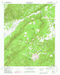
1957 Map of Mecca
USGS Topo · Published 1980About this map
Starr Mountain dominates this mid-century landscape in the heart of the Cherokee National Forest, marking the rugged transition between McMinn, Monroe, and Polk Counties. The area's social history is anchored by a network of rural churches and cemeteries, such as Wesley Chapel and the Conasauga Cem, which reflect the tight-knit mountain communities of the era. The presence of White Cliff Springs and several named water sources like Bullet Creek Falls and Gentry Spring highlight the importance of the local hydrology to early settlement and recreation.
Find a feature on this map
71 named features on this map. Tap any name to fly to it.
Don’t see what you’re looking for? This feature index may not catch every label — zoom into the map to look around manually.
Map Details
Editions of this 1957 Mecca Map
4 editions found
Other maps of this area

1886 · Cleveland
USGS Topo · 1:125,000

1892 · Cleveland
USGS Topo · 1:125,000

1893 · Murphy
USGS Topo · 1:125,000

1895 · Cleveland
USGS Topo · 1:125,000

1901 · Cleveland
USGS Topo · 1:125,000

1914 · Murphy
USGS Topo · 1:125,000

1934 · Mount Vernon
USGS Topo · 1:24,000

1934 · Mecca
USGS Topo · 1:24,000

1934 · Englewood
USGS Topo · 1:24,000

1934 · Tellico Plains
USGS Topo · 1:24,000