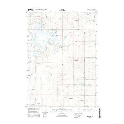
2014 Map of Mecosta NW
USGS Topo · Published 2014About this map
Barryton anchors the northeastern corner of this Mecosta County landscape, situated where the Chippewa River meets its western branch. The terrain is defined by a dense concentration of glacial lakes and wetlands, particularly within the Martiny Lake area. Notable water bodies such as Big Evans Lake, Tubbs Lake, and Halfmoon Lake create a complex hydrographic pattern across the northern half of the quadrangle.
Find a feature on this map
81 named features on this map. Tap any name to fly to it.
Don’t see what you’re looking for? This feature index may not catch every label — zoom into the map to look around manually.
Map Details
Editions of this 2014 Mecosta NW Map
This is the sole edition of this map. No revisions or reprints were ever made.
Other maps of this area

1954 · Midland
USGS Topo · 1:250,000

1958 · Midland
USGS Topo · 1:250,000

1958 · Big Rapids
USGS Topo · 1:62,500

1959 · Midland
USGS Topo · 1:250,000

1959 · Lake
USGS Topo · 1:62,500

1959 · Evart
USGS Topo · 1:62,500

1964 · Mecosta NW
USGS Topo · 1:24,000

1964 · Blanchard
USGS Topo · 1:24,000

1964 · Mecosta
USGS Topo · 1:24,000

1964 · Sherman City
USGS Topo · 1:24,000