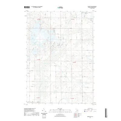
2019 Map of Mecosta NW
USGS Topo · Published 2019About this map
Mecosta and Barryton anchor this detailed survey of the glaciated wetlands and prairie-lake region of northern Michigan. The landscape is defined by an intricate network of kettle lakes and slow-moving water, including the sprawling Martiny Lake and the interconnected waters of Tubbs Lake, Upper Evans Lake, and Lower Evans Lake. These glacial remnants are joined by the winding course of the E Br Little Muskegon River and Pye Cr, which drain the lowlands of Hughes Swamp.
Find a feature on this map
60 named features on this map. Tap any name to fly to it.
Don’t see what you’re looking for? This feature index may not catch every label — zoom into the map to look around manually.
Map Details
Editions of this 2019 Mecosta NW Map
This is the sole edition of this map. No revisions or reprints were ever made.
Other maps of this area

1954 · Midland
USGS Topo · 1:250,000

1958 · Midland
USGS Topo · 1:250,000

1958 · Big Rapids
USGS Topo · 1:62,500

1959 · Midland
USGS Topo · 1:250,000

1959 · Lake
USGS Topo · 1:62,500

1959 · Evart
USGS Topo · 1:62,500

1964 · Mecosta NW
USGS Topo · 1:24,000

1964 · Blanchard
USGS Topo · 1:24,000

1964 · Mecosta
USGS Topo · 1:24,000

1964 · Sherman City
USGS Topo · 1:24,000