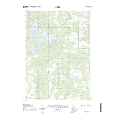
2023 Map of Mecosta NW
USGS Topo · Published 2023About this map
Barryton and Mecosta anchor the northern and southern reaches of this Mecosta County landscape, which is defined by a complex network of glacial lakes and river systems. The central terrain is characterized by the expansive waters of Tubbs Lake, Martiny Lake, and Diamond Lake, while the Chippewa River and its West Branch meander through the northeastern sections. Genealogists can identify several distinct burial grounds, including Mount Hope Cem, Dye Cem, and Flake Cem, which serve as vital markers of early settlement and community history. The area's hydrology is particularly intricate, featuring the East Branch Little Muskegon River flowing through the southern wetlands near Hughes Swamp. A dense grid of rural roads, such as 19 Mile RD and 65th Ave, provides access to numerous smaller water bodies like Boom Lake, Mud Lake, and Saddlebag Lake, reflecting the region's recreational and agricultural character in the modern era.
Find a feature on this map
85 named features on this map. Tap any name to fly to it.
Don’t see what you’re looking for? This feature index may not catch every label — zoom into the map to look around manually.
Map Details
Editions of this 2023 Mecosta NW Map
This is the sole edition of this map. No revisions or reprints were ever made.
Other maps of this area

1954 · Midland
USGS Topo · 1:250,000

1958 · Midland
USGS Topo · 1:250,000

1958 · Big Rapids
USGS Topo · 1:62,500

1959 · Midland
USGS Topo · 1:250,000

1959 · Lake
USGS Topo · 1:62,500

1959 · Evart
USGS Topo · 1:62,500

1964 · Mecosta NW
USGS Topo · 1:24,000

1964 · Blanchard
USGS Topo · 1:24,000

1964 · Mecosta
USGS Topo · 1:24,000

1964 · Sherman City
USGS Topo · 1:24,000