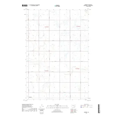
2017 Map of Medberry
USGS Topo · Published 2017About this map
Medberry stands as a primary point of reference in the southwestern corner of this LaMoure County landscape, situated within a grid of section lines that define the agricultural character of the region. The terrain is notably marked by the winding course of Cottonwood Cr, which meanders across the southern half of the quadrangle, cutting through the geometric precision of the township and range divisions. The map detail reflects the organized expansion of the rural North Dakota road network, where routes like Co Rd 34 and 90th Ave SE serve as the backbone for local transit between farmsteads. This 2017 survey provides a clear view of the intersection between natural hydrology and the Public Land Survey System, illustrating how local drainage patterns interact with the established boundaries of t134n r63w and surrounding townships.
Find a feature on this map
20 named features on this map. Tap any name to fly to it.
Don’t see what you’re looking for? This feature index may not catch every label — zoom into the map to look around manually.
Map Details
Editions of this 2017 Medberry Map
This is the sole edition of this map. No revisions or reprints were ever made.
Other maps of this area

1894 · La Moure
USGS Topo · 1:62,500

1895 · Lamoure
USGS Topo · 1:125,000

1896 · Jamestown
USGS Topo · 1:125,000

1896 · Edgeley
USGS Topo · 1:125,000

1897 · Eckelson
USGS Topo · 1:125,000

1918 · La Moure
USGS Topo · 1:125,000

1925 · Edgeley
USGS Topo · 1:125,000

1952 · Dickey
USGS Topo · 1:24,000

1953 · Jamestown
USGS Topo · 1:250,000

1953 · Adrian
USGS Topo · 1:24,000