
1955 Map of Medford
USGS Topo · Published 1964About this map
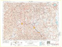
Medford and the surrounding Bear Creek Valley serve as the primary population hub in this mid-century portrait of Southern Oregon. The settlement pattern follows the Southern Pacific RR and the Rogue River, extending from the agricultural lands near Central Point and Talent to the industrial timber landscape of the Cascade Range. To the northeast, the iconic volcanic caldera of Crater Lake and its surrounding Crater Lake National Park dominate the high country, while the southwest is defined by the Siskiyou Mountains and the subterranean features of Oregon Caves National Monument. The map captures a period when the timber and fruit-packing industries were central to the local economy, reflected in the network of small communities like Phoenix and Gold Hill and the extensive system of fire lookouts and forest roads reaching into the Rogue River National Forest.
Find a feature on this map
129 named features on this map. Tap any name to fly to it.
Don’t see what you’re looking for? This feature index may not catch every label — zoom into the map to look around manually.
Map Details
Editions of this 1955 Medford Map
3 editions found
Other maps of this area

1886 · Modoc Lava Bed
USGS Topo · 1:250,000

1886 · Shasta
USGS Topo · 1:250,000

1889 · Klamath
USGS Topo · 1:250,000

1891 · Ashland
USGS Topo · 1:250,000

1892 · Modoc Lava-Bed
USGS Topo · 1:250,000

1893 · Ashland
USGS Topo · 1:250,000

1894 · Klamath
USGS Topo · 1:250,000

1894 · Shasta
USGS Topo · 1:250,000

1896 · Coos Bay
USGS Topo · 1:125,000

1897 · Roseburg
USGS Topo · 1:125,000