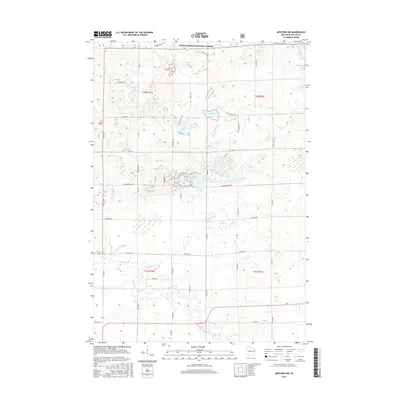
2015 Map of Medford NW
USGS Topo · Published 2015About this map
Chequamegon National Forest land dominates this section of Taylor County, where the dense hydrology of northern Wisconsin is on full display. The northern half of the quadrangle is characterized by a high concentration of glacial lakes, including Sackett Lake, Matt Ochs Lake, and the descriptively named Grassy Knoll Lake. These water bodies, along with the North Fork Yellow River, drain through a complex network of wetlands and creeks such as Leuthey Cr and Paugel Cr.
Find a feature on this map
70 named features on this map. Tap any name to fly to it.
Don’t see what you’re looking for? This feature index may not catch every label — zoom into the map to look around manually.
Map Details
Editions of this 2015 Medford NW Map
This is the sole edition of this map. No revisions or reprints were ever made.
Other maps of this area

1944 · Ogema
USGS Topo · 1:48,000

1945 · Black River
USGS Topo · 1:48,000

1947 · Ogema
USGS Topo · 1:48,000

1949 · Ogema
USGS Topo · 1:48,000

1949 · Jump River Fire Tower
USGS Topo · 1:48,000

1951 · Lublin
USGS Topo · 1:48,000

1951 · Medford
USGS Topo · 1:48,000

1953 · Rice Lake
USGS Topo · 1:250,000

1959 · Rice Lake
USGS Topo · 1:250,000

1969 · Perkinstown
USGS Topo · 1:24,000