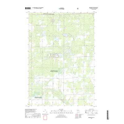
2018 Map of Medford NW
USGS Topo · Published 2018About this map
Chequamegon National Forest dominates the northern half of this Taylor County landscape, where glacial kettle lakes and marshy lowlands dictate the local geography. The area around Sackett Lake and Washington Flowage shows a transition from the protected forest lands to the agricultural and residential grids further south. Local history is anchored by the Molitor Cem near the western edge and various family-named landmarks such as Matt Sehs Lake and Anderson Lake. The complex drainage system is defined by the headwaters of the N Fork Yellow River and the Black River, which meander through a patchwork of public lands and areas designated as Farm Service Agency Interest of Wisconsin. This 2018 survey provides a clear look at the modern forest boundaries and the persistent rural road network including Perkinstown Ave and Co Hwy E.
Find a feature on this map
60 named features on this map. Tap any name to fly to it.
Don’t see what you’re looking for? This feature index may not catch every label — zoom into the map to look around manually.
Map Details
Editions of this 2018 Medford NW Map
This is the sole edition of this map. No revisions or reprints were ever made.
Other maps of this area

1944 · Ogema
USGS Topo · 1:48,000

1945 · Black River
USGS Topo · 1:48,000

1947 · Ogema
USGS Topo · 1:48,000

1949 · Ogema
USGS Topo · 1:48,000

1949 · Jump River Fire Tower
USGS Topo · 1:48,000

1951 · Lublin
USGS Topo · 1:48,000

1951 · Medford
USGS Topo · 1:48,000

1953 · Rice Lake
USGS Topo · 1:250,000

1959 · Rice Lake
USGS Topo · 1:250,000

1969 · Perkinstown
USGS Topo · 1:24,000