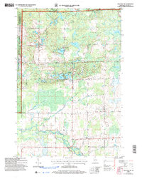
2005 Map of Medford NW
USGS Topo · Published 2006About this map
Glacial kettle lakes and dense woodlands characterize this portion of Taylor County, where the Chequamegon National Forest meets localized farming and recreation. The landscape is defined by the Ice Age Semi-Primitive Nonmotorized Area, a designation reflecting the geological heritage of the region's terminal moraines. Local civic life is anchored by small rural centers such as Murat and Washington, while the Molitor Cem and Brookside Sch provide clear markers for genealogists tracing family histories in the townships of Molitor, Hammel, and Medford. Water is a constant presence, from the winding Black River in the south to a cluster of named fishing and recreation spots like Sackett Lake, Long Lake, and the remote Grassy Knoll Lake. The map reveals a transition from managed timberlands and public recreation areas to the organized grid of private farmsteads and rural roads.
Find a feature on this map
38 named features on this map. Tap any name to fly to it.
Don’t see what you’re looking for? This feature index may not catch every label — zoom into the map to look around manually.
Map Details
Editions of this 2005 Medford NW Map
This is the sole edition of this map. No revisions or reprints were ever made.
Other maps of this area

1944 · Ogema
USGS Topo · 1:48,000

1945 · Black River
USGS Topo · 1:48,000

1947 · Ogema
USGS Topo · 1:48,000

1949 · Ogema
USGS Topo · 1:48,000

1949 · Jump River Fire Tower
USGS Topo · 1:48,000

1951 · Lublin
USGS Topo · 1:48,000

1951 · Medford
USGS Topo · 1:48,000

1953 · Rice Lake
USGS Topo · 1:250,000

1959 · Rice Lake
USGS Topo · 1:250,000

1969 · Perkinstown
USGS Topo · 1:24,000