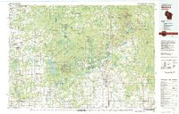
1980 Map of Medford
USGS Topo · Published 1980About this map
The Chequamegon National Forest dominates the central landscape of Taylor County in this 1980 survey, illustrating a region defined by its timbered tracts and glacial water systems. The Soo Line railroad provides a primary north-south transportation corridor through the settlements of Medford, Stetsonville, Whittlesey, and Westboro, reflecting the historic rail-reliant economy of the Wisconsin northwoods. In the western portion of the map, the North Fork Jump River and South Fork Jump River converge near Tony and Glen Flora, while conservation lands like the Pershing State Wildlife Area and Township Corners State Wildlife Management Area preserve the area's natural state. Significant elevation points such as Lawrence Lookout and Rib River Lookout offer vantage points over a terrain dotted with named features like Otter Lake and the Black River.
Find a feature on this map
164 named features on this map. Tap any name to fly to it.
Don’t see what you’re looking for? This feature index may not catch every label — zoom into the map to look around manually.
Map Details
Editions of this 1980 Medford Map
This is the sole edition of this map. No revisions or reprints were ever made.
Other maps of this area

1902 · Marathon
USGS Topo · 1:125,000

1939 · Mc Cord
USGS Topo · 1:48,000

1941 · Kennan
USGS Topo · 1:48,000

1941 · Phillips
USGS Topo · 1:48,000

1941 · Brantwood
USGS Topo · 1:48,000

1943 · Philliips
USGS Topo · 1:48,000

1943 · Brantwood
USGS Topo · 1:48,000

1944 · Ogema
USGS Topo · 1:48,000

1944 · Exeland
USGS Topo · 1:48,000

1945 · Kennan
USGS Topo · 1:48,000