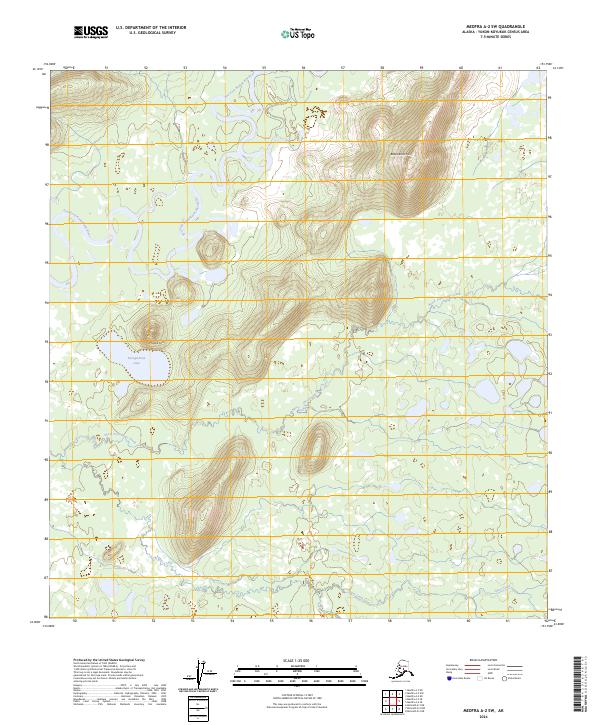
2024 Map of Medfra A-2 SW
USGS Topo · Published 2024About this map
The East Fork Kuskokwim River meanders through this interior Alaska landscape, defining a terrain of complex river bends and low-lying wetlands. Dominating the topography are prominent rises such as Moose Hill and Babybasket Hill, which stand as landmarks above the surrounding network of smaller drainages. This recent survey by the U.S. Geological Survey details the hydraulic patterns of North Fork Jones Creek and Jones Creek as they weave through a largely undeveloped wilderness. Below the heights of Moose Hill, the waters of Denagiemina Lake sit within a broad basin, illustrating the typical lake-and-marsh character of the Yukon-Koyukuk region. The absence of roads or established settlements emphasizes the remote, natural state of this interior river corridor, preserved in modern cartographic detail.
Find a feature on this map
15 named features on this map. Tap any name to fly to it.
Don’t see what you’re looking for? This feature index may not catch every label — zoom into the map to look around manually.
Map Details
Editions of this 2024 Medfra A-2 SW Map
This is the sole edition of this map. No revisions or reprints were ever made.
Other maps of this area

1949 · McGrath
USGS Topo · 1:250,000

1950 · Medfra
USGS Topo · 1:250,000

1950 · McGrath
USGS Topo · 1:250,000

1954 · McGrath D-3
USGS Topo · 1:63,360

1954 · Medfra A-3
USGS Topo · 1:63,360

1958 · McGrath D-2
USGS Topo · 1:63,360

1958 · Medfra A-2
USGS Topo · 1:63,360

1958 · McGrath
USGS Topo · 1:250,000

1959 · Medfra
USGS Topo · 1:250,000
2019 · McGrath D-2 NE
USGS Topo · 1:25,000