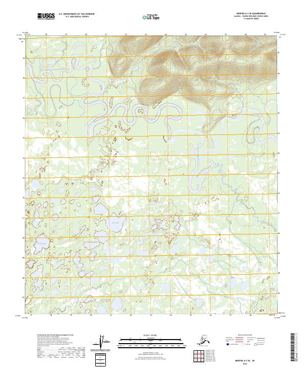
2024 Map of Medfra A-3 SE
USGS Topo · Published 2024About this map
The East Fork Kuskokwim River snakes across this interior landscape, forming an intricate series of oxbow bends and meanders that characterize the drainages of the Yukon-Koyukuk region. This 2024 survey depicts a wilderness environment where water dominates the geography, evidenced by the broad floodplains of Jones Creek and isolated bodies of water like Fish Lake and Round Lake. The absence of roads or permanent settlements within the survey boundaries emphasizes the remote, natural character of the terrain. The map serves as a contemporary record of the shifting river channels and seasonal wetlands that define this portion of the Alaskan interior, providing an essential reference for understanding the hydrography of the Kuskokwim watershed.
Find a feature on this map
10 named features on this map. Tap any name to fly to it.
Don’t see what you’re looking for? This feature index may not catch every label — zoom into the map to look around manually.
Map Details
Editions of this 2024 Medfra A-3 SE Map
This is the sole edition of this map. No revisions or reprints were ever made.
Other maps of this area

1949 · McGrath
USGS Topo · 1:250,000

1950 · Medfra
USGS Topo · 1:250,000

1950 · McGrath
USGS Topo · 1:250,000

1954 · McGrath D-3
USGS Topo · 1:63,360

1954 · Medfra A-3
USGS Topo · 1:63,360

1958 · McGrath D-2
USGS Topo · 1:63,360

1958 · Medfra A-2
USGS Topo · 1:63,360

1958 · McGrath
USGS Topo · 1:250,000

1959 · Medfra
USGS Topo · 1:250,000
2019 · McGrath D-2 NW
USGS Topo · 1:25,000