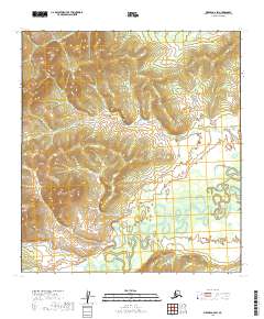
2019 Map of Medfra A-6 SW
USGS Topo · Published 2019About this map
Takotna River meanders through the southern half of this interior Alaska landscape, creating a complex network of oxbows and wetlands characteristic of the Yukon-Koyukuk region. The river's winding course indicates a low-gradient floodplain where seasonal changes heavily influence the local geography. To the northeast, the terrain transitions toward Porcupine Ridge, while the northern reaches are drained by John Reek Cr. In the southwest, Galickson Cr feeds into the larger river system. This 2019 survey documents a wilderness area largely defined by its natural watercourses and the lack of developed infrastructure, providing a clear record of the hydrography before any potential future alterations.
Find a feature on this map
10 named features on this map. Tap any name to fly to it.
Don’t see what you’re looking for? This feature index may not catch every label — zoom into the map to look around manually.
Map Details
Editions of this 2019 Medfra A-6 SW Map
This is the sole edition of this map. No revisions or reprints were ever made.
Other maps of this area

1949 · McGrath
USGS Topo · 1:250,000

1950 · Medfra
USGS Topo · 1:250,000

1950 · McGrath
USGS Topo · 1:250,000

1951 · Ophir
USGS Topo · 1:250,000

1951 · Iditarod
USGS Topo · 1:250,000

1954 · Medfra A-6
USGS Topo · 1:63,360

1954 · McGrath D-6
USGS Topo · 1:63,360

1954 · Ophir A-1
USGS Topo · 1:63,360

1954 · Ophir
USGS Topo · 1:250,000
1954 · Iditarod D-1
USGS Topo · 1:63,360