
1959 Map of Medfra
USGS Topo · Published 1967About this map
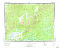
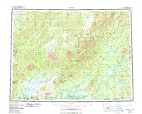
The Kuskokwim River drainage and the surrounding Alaskan interior define this 1959 survey, highlighting the remote settlements of Medfra and Nikolai along the water's edge. The landscape is a complex network of glacial rivers and mountain ranges, including the Sischu Mountains and Sunshine Mts. One can trace the historic Winter Trail as it cuts across the lowlands, providing a vital connection through the subarctic terrain. To the north, the small settlement of Poorman sits near the headwaters of the Sulatna River, while the southern reaches are dominated by the winding paths of the Nixon Fork and Tonzona River. This era of mapping captured the region before significant modern development, documenting family-named landmarks like Von Frank Mountain and Wilson Hill alongside numerous unnamed lakes and swampy flats that characterize the Interior's vast river basins.
Find a feature on this map
70 named features on this map. Tap any name to fly to it.
Don’t see what you’re looking for? This feature index may not catch every label — zoom into the map to look around manually.
Map Details
Editions of this 1959 Medfra Map
3 editions found
Other maps of this area

1945 · Nulato
USGS Topo · 1:250,000

1948 · Kantishna River
USGS Topo · 1:250,000

1949 · McGrath
USGS Topo · 1:250,000

1950 · Medfra
USGS Topo · 1:250,000

1950 · McGrath
USGS Topo · 1:250,000

1950 · Talkeetna
USGS Topo · 1:250,000

1951 · Talkeetna
USGS Topo · 1:250,000

1951 · Ophir
USGS Topo · 1:250,000

1951 · Nulato
USGS Topo · 1:250,000

1951 · Kantishna River
USGS Topo · 1:250,000