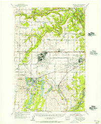
1954 Map of Medical Lake
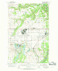
USGS Topo · Published 1969About this map
Fairchild Air Force Base and Geiger AFB dominate the central landscape of this mid-century Spokane County survey, reflecting the region's massive military footprint during the Cold War. To the southwest, the town of Medical Lake is surrounded by a dense cluster of water bodies including West Medical Lake, Silver Lake, and Clear Lake, as well as the sprawling campus of Eastern State Hospital and Lakeland Village.
Find a feature on this map
70 named features on this map. Tap any name to fly to it.
Don’t see what you’re looking for? This feature index may not catch every label — zoom into the map to look around manually.
Map Details
Editions of this 1954 Medical Lake Map
2 editions found
Other maps of this area

1901 · Spokane
USGS Topo · 1:125,000

1903 · Oakesdale
USGS Topo · 1:125,000

1905 · Oakesdale
USGS Topo · 1:125,000

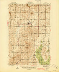
1943 · Medical Lake
USGS Topo · 1:62,500

1944 · Clayton
USGS Topo · 1:62,500

1944 · Wellpinit
USGS Topo · 1:62,500
1945 · Reardan
USGS Topo · 1:62,500

1949 · Deer Park
USGS Topo · 1:62,500

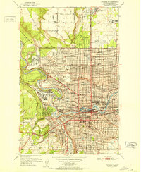
1950 · Spokane SW
USGS Topo · 1:24,000
1950 · Spokane NW
USGS Topo · 1:24,000