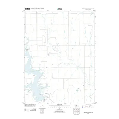
2011 Map of Medicine Creek Dam
USGS Topo · Published 2011About this map
Harry Strunk Lake dominates this Frontier County landscape, a reservoir formed by the Medicine Creek Dam in the southwestern corner of the quadrangle. The surrounding terrain is defined by the winding course of Deer Creek, which feeds the lake from the north, and the deeply incised Mitchell Creek Canyon to the west. This 2011 survey captures a quiet rural district where legacy sites like Pleasant View Cemetery and Hammond Cemetery sit alongside modern recreational areas such as Shady Bay Campground and Trail Twelve Campground.
Find a feature on this map
15 named features on this map. Tap any name to fly to it.
Don’t see what you’re looking for? This feature index may not catch every label — zoom into the map to look around manually.
Map Details
Editions of this 2011 Medicine Creek Dam Map
This is the sole edition of this map. No revisions or reprints were ever made.
Other maps of this area

1902 · Gothenburg
USGS Topo · 1:125,000

1954 · McCook
USGS Topo · 1:250,000

1956 · Freedom
USGS Topo · 1:24,000

1956 · Cambridge
USGS Topo · 1:24,000

1956 · Medicine Creek Dam
USGS Topo · 1:24,000

1956 · Bartley
USGS Topo · 1:24,000

1956 · Stockville SE
USGS Topo · 1:24,000

1957 · McCook
USGS Topo · 1:250,000

1958 · McCook
USGS Topo · 1:250,000
1958 · Holbrook
USGS Topo · 1:24,000