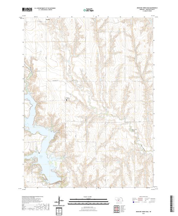
2021 Map of Medicine Creek Dam
USGS Topo · Published 2021About this map
Harry Strunk Lake and the Medicine Creek Dam dominate this Frontier County landscape, illustrating the mid-century water management projects that transformed the Nebraska plains. The reservoir, created by the damming of Deer Cr, serves as a central hub for the surrounding ranching and farming lands. The small settlement of Orafino sits to the north, connected by a network of rural routes like Lake Rd and Rd 407 that navigate the deeply incised drainages. The terrain is defined by dramatic erosion patterns, notably Mitchell Creek Canyon and Deer Creek Canyon, which reveal the complex topography of the Republican River basin. Local history and genealogy interests are anchored by the Pleasant View Cem, while smaller water features like Brusle Reservoir and W Muddy Cr show the localized hydrology of the region.
Find a feature on this map
26 named features on this map. Tap any name to fly to it.
Don’t see what you’re looking for? This feature index may not catch every label — zoom into the map to look around manually.
Map Details
Editions of this 2021 Medicine Creek Dam Map
This is the sole edition of this map. No revisions or reprints were ever made.
Other maps of this area

1902 · Gothenburg
USGS Topo · 1:125,000

1954 · McCook
USGS Topo · 1:250,000

1956 · Freedom
USGS Topo · 1:24,000

1956 · Cambridge
USGS Topo · 1:24,000

1956 · Medicine Creek Dam
USGS Topo · 1:24,000

1956 · Bartley
USGS Topo · 1:24,000

1956 · Stockville SE
USGS Topo · 1:24,000

1957 · McCook
USGS Topo · 1:250,000

1958 · McCook
USGS Topo · 1:250,000
1958 · Holbrook
USGS Topo · 1:24,000