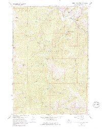
1965 Map of Medicine Hot Springs
USGS Topo · Published 1992About this map
Medicine Hot Springs serves as the focal point of this mid-1960s survey, situated along the East Fork Bitterroot River in the heart of the Bitterroot National Forest. The landscape is defined by its numerous drainages and thermal features, with recreation sites like Warm Springs Campground and Spring Gulch Campground established to serve visitors to the river valley. The topography rises sharply from the river bottom toward prominent heights such as Shook Mountain and Coyote Peak.
Find a feature on this map
44 named features on this map. Tap any name to fly to it.
Don’t see what you’re looking for? This feature index may not catch every label — zoom into the map to look around manually.
Map Details
Editions of this 1965 Medicine Hot Springs Map
3 editions found

Other maps of this area

1955 · Dillon
USGS Topo · 1:250,000

1956 · Elk City
USGS Topo · 1:250,000

1957 · Dillon
USGS Topo · 1:250,000

1958 · Dillon
USGS Topo · 1:250,000

1960 · Elk City
USGS Topo · 1:250,000

1960 · Piquett Mountain
USGS Topo · 1:62,500

1962 · Dillon
USGS Topo · 1:250,000

1964 · Burnt Ridge
USGS Topo · 1:24,000
1964 · Robbins Gulch
USGS Topo · 1:24,000

1964 · Piquett Creek
USGS Topo · 1:24,000