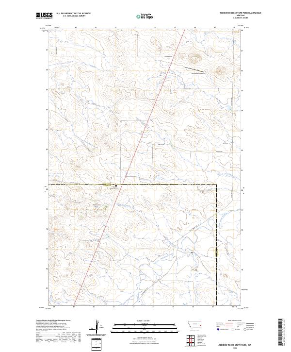
2024 Map of Medicine Rocks State Park
USGS Topo · Published 2024About this map
Medicine Rock Church Cem serves as a central landmark at the southern edge of this Montana landscape, where the border of Fallon and Carter Counties divides the terrain. The area is defined by a dense network of seasonal drainages, including Bone Pile Creek in the north and the winding course of Little Beaver Creek to the south. These waterways carve through the high plains, punctuated by distinctive geological features such as Roosevelt Rock. Isolated ranching infrastructure, such as the Sikorski Ranch Airport near Longview Rd, points to the logistical requirements of managing large territorial holdings. The map details a transition from the South Fork Milk Creek drainage to the broader valleys of Sheep Camp Creek and Greasewood Creek, reflecting the remote, water-dependent character of eastern Montana's ranching country.
Find a feature on this map
23 named features on this map. Tap any name to fly to it.
Don’t see what you’re looking for? This feature index may not catch every label — zoom into the map to look around manually.
Map Details
Editions of this 2024 Medicine Rocks State Park Map
This is the sole edition of this map. No revisions or reprints were ever made.
Other maps of this area

1953 · Miles City
USGS Topo · 1:250,000

1954 · Ekalaka
USGS Topo · 1:250,000

1956 · Ekalaka
USGS Topo · 1:250,000

1957 · Miles City
USGS Topo · 1:250,000

1958 · Miles City
USGS Topo · 1:250,000

1958 · Ekalaka
USGS Topo · 1:250,000

1965 · Ekalaka
USGS Topo · 1:250,000

1979 · Ekalaka
USGS Topo · 1:24,000

1980 · Dutchmans Hill
USGS Topo · 1:24,000
1980 · Terrell Creek
USGS Topo · 1:24,000