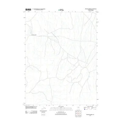
2012 Map of Medicine Spring
USGS Topo · Published 2012About this map
Silver Butte Consolidated Mining Company Mill serves as a prominent industrial landmark in this high-altitude landscape of eastern Elko County. The map details a network of unimproved roads and ephemeral drainages, centered around the life-sustaining waters of Medicine Spring and Mud Spring. This 2012 survey illustrates the isolated nature of the terrain, where transportation is defined by long stretches of the Butte Valley Rd. The presence of the mining mill reflects the area's continued association with Nevada's mineral extraction history, providing a precise spatial record for researchers tracking industrial footprints in Butte Valley. This is a characteristic snapshot of the Great Basin's basin-and-range topography, where water sources and mining operations dictate the human geography.
Find a feature on this map
4 named features on this map. Tap any name to fly to it.
Don’t see what you’re looking for? This feature index may not catch every label — zoom into the map to look around manually.
Map Details
Editions of this 2012 Medicine Spring Map
This is the sole edition of this map. No revisions or reprints were ever made.
Other maps of this area

1955 · Elko
USGS Topo · 1:250,000

1958 · Elko
USGS Topo · 1:250,000

1962 · Elko
USGS Topo · 1:250,000

1965 · Elko
USGS Topo · 1:250,000

1968 · Franklin Lake SE
USGS Topo · 1:24,000

1968 · Franklin Lake NE
USGS Topo · 1:24,000

1968 · Ruby Lake NE
USGS Topo · 1:24,000

1984 · West of Delcer Buttes
USGS Topo · 1:24,000
1984 · High Bald Peaks
USGS Topo · 1:24,000

1984 · Delcer Buttes
USGS Topo · 1:24,000